Category:Beaver Creek Valley State Park
Jump to navigation
Jump to search
English: Lat: 43°39′0″N LNG: 91°34′58″W
Notice: Most of the images in this category in May 2016 have very terse descriptions.
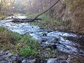
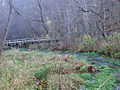
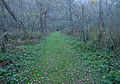
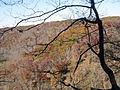
Beaver Creek Valley State Park is a state park of Minnesota, United States, featuring a steep, narrow valley carved by East Beaver Creek. This spring-fed stream is a fishing destination for its native brook trout, and introduced brown trout. The heavily forested valley, up to 250 feet (76 m) 250 feet (76 m) deep in places, is a hidden natural oasis amidst the farmland of southeastern Minnesota. Located near the town of Caledonia, the park was developed in the 1930s by the Works Progress Administration. The parkland exhibits the highly stream-carved terrain characteristic of the Driftless Area.
Notice: Most of the images in this category in May 2016 have very terse descriptions.
state park in Minnesota, United States  | |||||
| Upload media | |||||
| Instance of | |||||
|---|---|---|---|---|---|
| Location | Houston County, Minnesota | ||||
| IUCN protected areas category | |||||
| Inception |
| ||||
| official website | |||||
 | |||||
Media in category "Beaver Creek Valley State Park"
The following 25 files are in this category, out of 25 total.
-
 Beaver Creek Valley State Park Entrance Sign - Southern Minnesota (36576406625).jpg 5,126 × 3,449; 12.35 MB
-
 Beaver Creek Valley State Park Forest - Caledonia, Minnesota (36576548645).jpg 5,760 × 3,840; 27.3 MB
-
 BeaverCreekValleyStatePark1.jpg 800 × 500; 195 KB
-
 BeaverStream.jpg 960 × 720; 244 KB
-
 Branchoverhangingbrook.jpg 2,343 × 1,482; 798 KB
-
 Gfp-minnesota-beaver-creek-valley-another-mini-waterfall.jpg 2,376 × 1,782; 924 KB
-
 Gfp-minnesota-beaver-creek-valley-bridge-across-beaver-creek.jpg 2,376 × 1,782; 1.24 MB
-
 Gfp-minnesota-beaver-creek-valley-clear-view-of-the-forest.jpg 2,376 × 1,782; 991 KB
-
 Gfp-minnesota-beaver-creek-valley-forest-view-between-2-trees.jpg 2,376 × 1,782; 1,005 KB
-
 Gfp-minnesota-beaver-creek-valley-forest.jpg 2,376 × 1,782; 1.28 MB
-
 Gfp-minnesota-beaver-creek-valley-hiking-club-cabin.jpg 2,109 × 1,198; 502 KB
-
 Gfp-minnesota-beaver-creek-valley-hiking-path.jpg 2,346 × 1,637; 993 KB
-
 Gfp-minnesota-beaver-creek-valley-late-autumn-forest.jpg 2,376 × 1,782; 1.01 MB
-
 Gfp-minnesota-beaver-creek-valley-leaves-on-the-forest-floor.jpg 2,376 × 1,782; 1.02 MB
-
 Gfp-minnesota-beaver-creek-valley-looking-into-the-forest.jpg 2,376 × 1,782; 1.24 MB
-
 Gfp-minnesota-beaver-creek-valley-mini-rapids.jpg 2,376 × 1,782; 1.41 MB
-
 Gfp-minnesota-beaver-creek-valley-miss-on-rock.jpg 2,376 × 1,782; 1.39 MB
-
 Gfp-minnesota-beaver-creek-valley-rapids.jpg 2,376 × 1,782; 1.32 MB
-
 Gfp-minnesota-beaver-creek-valley-scenic-view-of-the-creek.jpg 2,142 × 1,396; 830 KB
-
 Gfp-minnesota-beaver-creek-valley-steps-on-the-trail.jpg 2,376 × 1,782; 1.34 MB
-
 Gfp-minnesota-beaver-creek-valley-stream-view.jpg 2,160 × 1,620; 733 KB
-
 Gfp-Minnesota-beaver-creek-valley-view-of-hill-top.jpg 2,376 × 1,782; 1.25 MB
-
 Hikingclubcabin.jpg 2,109 × 1,198; 489 KB
-
 Lateautumnforest.jpg 2,376 × 1,782; 934 KB
-
 Steep Rock Trail - Beaver Creek Valley State Park (37269617965).jpg 5,760 × 3,840; 20.39 MB
.jpg)
.jpg)


.jpg)